The last time I stood on the banks of the Grand Canal in Yangzhou, an elderly man was hauling water up from the canal with a rope and a bucket — the same way his grandfather had done, and his grandfather before that. The canal has been doing this job for over two thousand years.
That’s the thing about the Grand Canal. It’s not a monument you visit. It’s a living infrastructure project that still breathes. While the Great Wall gets all the glory in travel brochures, the Grand Canal is older, longer, and arguably more important to how China worked as a civilization. It moved grain. It moved salt. It moved armies. It moved ideas. And it connected Beijing to Hangzhou — a straight-line distance of over 1,100 kilometers, but along the canal’s winding waterway, closer to 1,792 kilometers of continuous navigable route.
The Engineering Marvel That Took 2,500 Years to Build
When I tell people the Grand Canal is 1,776 kilometers long, I usually get a blank stare. Let me put it another way: if you walked the entire length at a steady pace, it would take you about three weeks. The canal crosses five major river systems. It climbs from the flat plains of eastern China up to the higher elevations near Beijing using a system of locks that still function today. Twenty-four major lock complexes manage the elevation changes, some lifting boats nearly 40 meters in total elevation gain from south to north.
The canal wasn’t built all at once. Different dynasties dug different sections over roughly 2,500 years. The oldest sections date back to the 5th century BCE, when the State of Wu dug channels to move troops during the Spring and Autumn Period. The Kingdom of Qi dug its own canals around the same time for grain transport. These early segments were patchwork — regional solutions to regional problems.
Then came the Sui Dynasty.
In 581 CE, a general named Yang Jian统一 China and declared himself Emperor Wen of Sui. His son, Emperor Yang (often called Yang Guang), inherited the throne in 604 CE and immediately launched what can only be described as the most ambitious infrastructure project of the pre-industrial world. He connected the northern Yellow River system to the southern Yangtze system, building the central spine of what we now call the Grand Canal.
The human cost was staggering. Conservative estimates put the labor force at 5 to 6 million workers — some accounts suggest higher. These weren’t volunteers. Corvée labor laws required able-bodied men to serve. The canal was dug largely by hand: shovels, baskets, and human muscle. When the project faced delays, officials accelerated the timeline by adding more workers, which is ancient project management-speak for “forcing people to work faster under worse conditions.” Flooding killed thousands. Disease swept through the labor camps. The canal earned Emperor Yang a reputation for ruthlessness that persists in Chinese historical memory to this day.
But by 611 CE, the main route was open. By 618 CE — the year the Sui Dynasty fell — the canal was operational. The new Tang Dynasty inherited a unified waterway running from the capital at Chang’an (via connecting routes) all the way south to the Yangtze Delta.
The Grain Highway: How the Canal Fed an Empire
Here’s the thing that clicked for me only after reading several rounds of academic papers: the Grand Canal was built for one primary reason, and it wasn’t commerce. It was grain.
The Tang, Song, Yuan, Ming, and Qing dynasties all faced the same fundamental problem. The imperial capital was in the north — first Chang’an, then Kaifeng, then Beijing — but the agricultural surplus was in the south. The Yangtze River Delta and the Pearl River Delta were producing far more rice and grain than those northern regions could consume. Moving that grain overland was impossible before railroads. A mule could carry about 100 kilograms. A boat on the canal could carry 300 to 500 tons.
This system had a name: the Caoyun, or “Grain Transport.” It was a state monopoly. Every year, the government collected grain taxes from the southern provinces. That grain was loaded onto barges and shipped north via the canal to feed the capital’s population — the emperor’s court, the imperial bureaucracy, the military garrisons defending the northern frontier. At its peak during the Ming and Qing dynasties, the Caoyun system moved between 4 and 6 million shi of grain annually. A shi is roughly 100 liters by volume, and depending on the grain type, could weigh 50 to 70 kilograms. Do the math: that’s hundreds of thousands of tons of grain per year, year after year, century after century.
The canal towns grew fat on this flow. Yangzhou sat at the intersection of the Grand Canal and the Yangtze River — the nexus of north-south trade. Its merchant class became one of the wealthiest in China. Suzhou, Hangzhou, and the towns along the Jiangsu section developed distinctive architectural styles, canal-side restaurants, and a culture built around waterborne commerce. I spent three days in Hangzhou last year and kept finding small temples and old warehouses tucked behind the modern streets — remnants of the city’s days as the southern terminus of the canal system.
The salt trade was equally important. Western China’s salt mines produced mineral salt that was cheaper and more abundant than sea salt. The canal moved this western salt eastward, while southern sea salt moved westward. Government salt warehouses dotted the canal route. The “salt tax” was one of the most reliable revenue sources for imperial treasuries for over a thousand years.
Beijing, Hangzhou, and the Canal’s Southern Terminus
When Kublai Khan founded the Yuan Dynasty in 1271, he made a strategic decision that shaped Chinese history: he moved the capital to Dadu (what is now Beijing). Beijing sits at the northern end of the Grand Canal’s current route, but it wasn’t originally connected to the southern system the way it is today.
Genghis Khan’s grandson faced a logistics nightmare. The old Sui-Tang canal route had fallen into disrepair during the Song-Yuan transition. Dadu’s food supply depended on a combination of overland transport and a partial canal system that didn’t reach the Yangtze Delta. The solution, engineered by a Nepali-Buddhist engineer named Agan, was to complete the final northern connection: the Jinghang Canal, running from Dadu south to meet the existing canal system near Tianjin.
The project was finished in 1293. It extended the total navigable route to approximately 1,792 kilometers. Beijing became the northern anchor of a system that ran unbroken to Hangzhou, the southern terminus and the capital of the Southern Song Dynasty (which had been defeated by Kublai Khan’s forces, but Hangzhou remained a major commercial city).
Hangzhou’s place in Chinese cultural memory is secure regardless of politics. Marco Polo visited during the Yuan Dynasty and called it “the most beautiful and magnificent city in the world.” The West Lake — a natural lake within the city, connected to the canal system by waterways — became the subject of poets, painters, and the Chinese cultural imagination in ways that still shape tourism today. I visited on a misty October morning and understood immediately why Chinese painters kept returning to this scene: the lake, the surrounding hills, the causeways — it’s genuinely beautiful.
The northern terminus near Beijing is less romantic but more consequential. The Tongzhou Canal District was the arrival point for grain barges coming from the south. From here, the grain was transferred to smaller boats that could navigate the city’s waterways, or loaded onto carts for the final stretch to the imperial granaries. Today, this area is undergoing rapid urban redevelopment, and the old canal warehouses are being converted into museums and cultural spaces.
Recommended Products
[product_affiliate: “The Cambridge History of China: Vol 5 - The Sui Dynasty” - https://www.amazon.com/dp/0521203733] [product_affiliate: “China’s Imperial Canal: A Cultural History” - https://www.amazon.com/dp/1933947852] [product_affiliate: “Traditional Chinese Waterway Map Print” - https://www.etsy.com/market/grand_canal]
UNESCO, Preservation, and the Canal Towns Today
In 2014, UNESCO inscribed the Grand Canal as a World Heritage Site — not the entire 1,776 kilometers, but a 1,000-kilometer core section representing the canal’s most historically significant segments. The inscription recognized the canal as “the greatest ancient waterway engineering project in the world” — a significant statement given that UNESCO evaluates projects globally.
The preservation challenge is real. The canal isn’t a single historical artifact; it’s a 2,500-year-old living infrastructure system that millions of people still use daily. Sections in Shandong Province have been restored to navigable condition and host tourist boat rides. The Jiangsu section, from Nanjing to Suzhou, is the most well-preserved and sees active commercial traffic. The northern sections near Beijing and Tianjin have suffered from industrial development and neglect, though restoration projects are ongoing.
The UNESCO designation came with strings attached: member nations are required to protect the canal’s integrity, manage visitor impacts, and maintain the waterway’s ecological health. This has funneled preservation funding into canal towns that might otherwise have been redeveloped without archaeological oversight.
What strikes me about the canal towns is how different they are from each other. Suzhou is refined — its canal-side gardens are world-famous, and the city has invested heavily in canal tourism. Yangzhou is more working-class, with a tradition of盐水鸭 (saltwater duck) and a grittier commercial history. The canal towns in Shandong have a more rustic character, their stone bridges and old warehouses less polished for tourists.
I spent a week traveling the canal by slow boat between Yangzhou and Suzhou — the kind of journey that takes four hours today but would have taken weeks in the imperial era. The water is murky in places, clean in others. Herons stand motionless in the shallows. Barges carry sand and gravel alongside tourist boats. The landscape changes gradually: flat Jiangsu plains, occasional hills, villages with red-tile roofs. It feels less like visiting a historical site and more like traveling on a thread that has been continuous for centuries.
Why the Grand Canal Matters More Than the Great Wall
Here’s an argument I’ve made to friends who think I’m being contrarian: the Great Wall is iconic, but the Grand Canal is more important.
The Great Wall is a defense project. It protected northern borders from invasion, and it did that job reasonably well for several centuries. But it was fundamentally a military installation — expensive to maintain, and ultimately breached by the Manchus in 1644 who simply bribed their way through the gates.
The Grand Canal was an economic project. It kept the empire fed. It moved resources from where they were abundant to where they were needed. It created a unified internal market that made China economically integrated in ways that Europe wouldn’t achieve until the Industrial Revolution. The canal was why the Chinese state could maintain a standing army at its northern frontier — because that army could be fed from southern surpluses via the canal, rather than being dependent on whatever the northern steppes could produce.
Without the Grand Canal, the Tang might not have been able to project power into Central Asia. The Song might not have been able to maintain their grip on the south. The Ming’s Beijing capital might have been unsustainable without the southern grain supply. The canal wasn’t just a transportation route — it was the circulatory system of imperial China.
And it still works. Freight barges still move along the canal. Local governments still maintain the locks. The waterway that fed the empire still carries sand, gravel, and occasionally tourists.
The elderly man I mentioned in Yangzhou — he told me his family has lived on this canal bank for six generations. When I asked if he thought the canal was important, he shrugged and said, “It’s just here. It always has been.”
That’s probably the most honest thing anyone has ever said about the Grand Canal. It’s not a symbol or a monument. It’s infrastructure — and it’s been doing its job for two and a half thousand years.
Quick Reference: Grand Canal by the Numbers
| Metric | Value |
|---|---|
| Total length | 1,776 km (1,104 miles) |
| Navigable length (Beijing–Hangzhou) | 1,792 km |
| Construction started | 5th century BCE (various sections) |
| Main connection completed | Sui Dynasty, 618 CE |
| Final northern extension (Jinghang) | 1293, Yuan Dynasty |
| UNESCO World Heritage inscription | 2014 |
| Major lock systems | 24 |
| Elevation gain (south to north) | ~40 meters |
| Peak grain transport (Ming/Qing) | 4–6 million shi per year |
Conclusion
The Grand Canal isn’t a story about emperors and construction projects, though both make for dramatic reading. It’s a story about what happens when a civilization commits to solving a fundamental logistical problem — moving resources across vast distances — and then maintains that solution for over two millennia. The engineering is remarkable. The human cost is sobering. The ongoing utility is, frankly, astonishing. If you’re interested in how China worked before trains and trucks, the canal is where the answer lives.
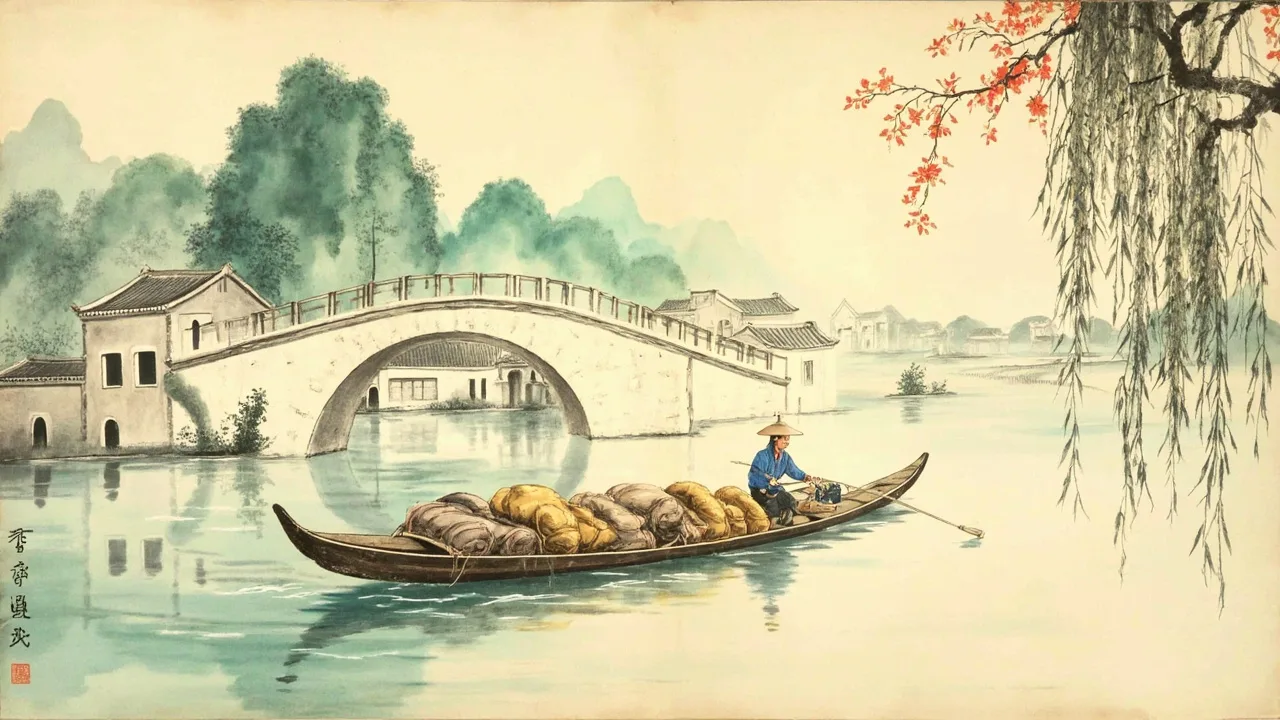
{ “subject”: “A vast ancient Chinese waterway stretching to the horizon, cargo barges with weathered wooden hulls and straw awnings gliding through calm jade-green canal waters under soft morning mist. Traditional canal towns with grey-tiled roofs and stone arch bridges line both banks. In the distance, distant mountains fade into atmospheric haze. In the foreground, a lone figure in traditional clothing stands on a wooden pier, gazing north along the canal.”, “style”: “Traditional Chinese landscape painting (shan shui 水墨山水) with cinematic lighting and atmospheric perspective. Ink wash technique with subtle color washes. Museum-quality brushwork with visible texture. Realistic yet stylized, avoiding flat digital aesthetics.”, “negative_prompt”: “Avoid cartoonish style, avoid AI-generated look, avoid generic Chinese clipart aesthetic, avoid oversaturated colors, avoid flat shading, avoid Western oil painting style, avoid modern elements, avoid people in contemporary clothing”, “characters”: “Single elderly Chinese man in traditional clothing standing on a wooden pier in foreground, seen from behind”, “environment”: “Misty morning on the Grand Canal near Yangzhou, soft diffused light, calm water with gentle reflections, seasonal atmosphere suggesting autumn”, “composition”: “Wide panoramic view, canal receding to vanishing point at horizon, subject placed using rule of thirds in lower left quadrant” }