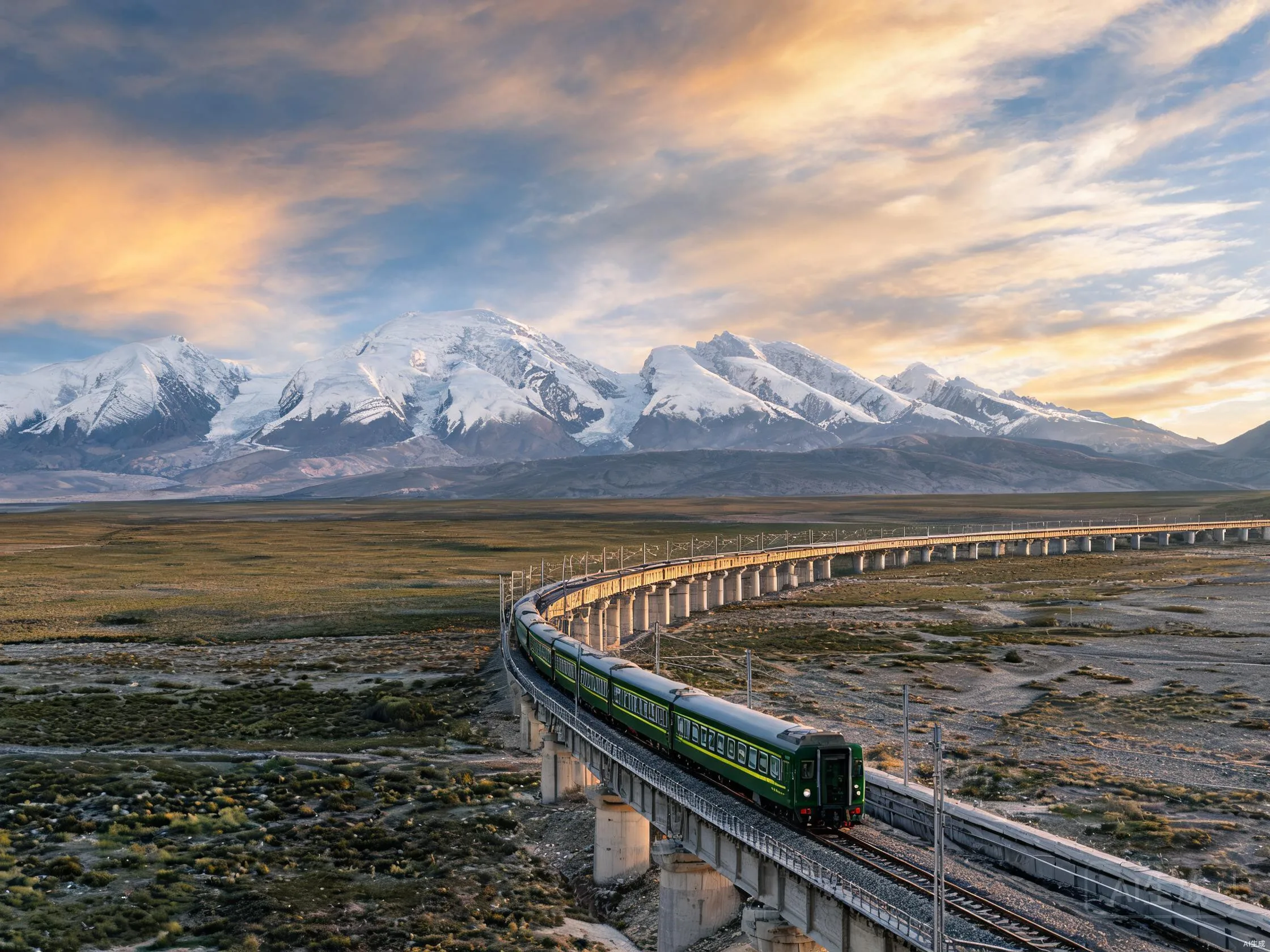
When the first passenger train pulled into Lhasa station on July 1, 2006, the platform was full of Tibetan monks, Han Chinese workers, foreign journalists, and a few bewildered yak. After nearly five decades of broken plans, two separate construction phases, an aborted Soviet-era effort in the 1950s, and roughly $3.6 billion in actual money spent, China had finished the highest railway on Earth. The Qinghai-Tibet Railway (青藏铁路, Qīngzàng tiělù) runs 1,956 kilometers from Xining in Qinghai Province to Lhasa in the Tibet Autonomous Region, crossing permafrost (ground that stays frozen year-round), salt lakes, mountain ranges nobody had ever laid track across before, and altitudes where the air contains about 40% of the oxygen it does at sea level. The Tanggula Pass station sits at 5,068 meters. The track itself tops out at 5,072 meters. For comparison, the summit of Mont Blanc is 4,808 meters, and the highest paved road in North America (the Mount Evans Scenic Byway) crests at 4,310.
This is an article about how that railway got built, what the trip is actually like, and why the engineering decisions made on a frozen plateau in the 2000s still matter. It is not a hagiography — the project was politically controversial, displaced Tibetan herders, and the geopolitical story is complicated — but it is genuinely one of the most impressive pieces of civil engineering done anywhere in the 21st century.
Why This Railway Exists At All
The short answer: nationalism, defense, and development. The longer answer starts in 1958, when Mao Zedong ordered the first attempt at a Golmud-to-Lhasa rail line. The Chinese Ministry of Railways surveyed a route, sank some test pilings, and built a short demonstration track. Then the Great Leap Forward collapsed, funding dried up, and the line sat on paper for nearly three decades. A second push began in 1974 and ran until 1984, when the western section from Xining to Golmud opened — 846 km of mostly conventional high-plateau railway across the Qaidam Basin. That section is real and has been in service since 1984. It is not the famous part. The famous part is the second phase: Golmud to Lhasa, 1,142 km, of which roughly 550 km crosses continuous permafrost. Construction began on June 29, 2001, and was completed in five years, a pace that surprised most of the foreign engineers invited to consult.
Why was Beijing willing to spend the money? Three reasons, in order of how much the planners cared about each.
Political integration. Tibet has been administered by the People’s Republic since 1951, but until 2006 it had no fixed rail link to the rest of China. Everything moved in by road or air. Trucks crawled up the Qinghai-Tibet Highway and Sichuan-Tibet Highway, both of which close for weeks in winter. A railway is a permanent, weather-independent umbilical cord. Once it’s running, the central government can move troops, equipment, administrators, and tourists at a speed and volume that highways can’t match.
Economic development of the western interior. The Qaidam Basin is one of China’s most important resource regions. It holds major deposits of lithium (used in batteries), boron, potash, magnesium, and natural gas. The Tibet Autonomous Region has copper, chromite, and gold. Getting those minerals out cheaply requires rail, not trucks.
Tourism and Han Chinese migration. Before the railway, getting to Lhasa was a serious undertaking. After 2006, you could board a soft-sleeper train in Beijing on a Tuesday evening and arrive in Lhasa on Friday afternoon. Tourist arrivals to Tibet jumped from about 1.8 million in 2005 to over 8 million by 2010 and have continued growing. The railway didn’t just enable tourism; it changed the demographic mix of who visits.
The decision to build wasn’t really about whether it was technically possible. By 2001, China had the capital, the construction companies, the engineering schools, and the political will. The interesting question was always how — and specifically, how do you lay 550 km of track on ground that is frozen solid most of the year, briefly thaws in summer, and would, under normal practice, liquefy under the weight of a train?
The Permafrost Problem
This is the engineering problem that defines the Qinghai-Tibet Railway, and the one that foreign observers were most skeptical about. Continuous permafrost underlies roughly 70% of the Qinghai-Tibet Plateau, with the ground frozen to depths of 100 meters or more in places. Permafrost is not just frozen dirt. It is a structural material: ice fills the spaces between soil particles and acts as a kind of natural cement, holding the ground together. Heat that ground — by, say, building an embankment that absorbs summer sun — and the ice melts, the cement disappears, and the ground slumps. Engineers call this thaw subsidence (settling caused by frozen ground melting). In Siberia, Canada, and Alaska, thaw subsidence has been the bane of every railway and pipeline ever built on permafrost. The Trans-Siberian Railway still has to constantly rework its embankments across the Yakutian permafrost zone.
The traditional Russian and Canadian approach is mostly avoidance: build elevated tracks on pile foundations driven deep into the permafrost, well below the active layer (the top few meters that thaws each summer and refreezes in winter). This works, but it’s expensive. China chose a different approach for the Qinghai-Tibet Railway, and the decision is genuinely interesting from an engineering standpoint.
The Chinese engineers, working primarily from the Cold and Arid Regions Environmental and Engineering Research Institute in Lanzhou, designed a system that does something no other major permafrost railway does at this scale: it actively cools the permafrost instead of trying to work around it. The technique is called a “thermosyphon embankment,” and at its simplest, it consists of two-meter-tall vertical metal pipes filled with ammonia (or another refrigerant) embedded in the embankment. In winter, the ambient air is colder than the ground, the ammonia in the pipe evaporates from the warm bottom and condenses at the cold top, and the natural convection (the tendency of warm fluid to rise and cool fluid to sink) cycle pumps heat out of the embankment and dumps it into the air. In summer, the system is engineered to shut down — the air is warmer than the ground, so convection reverses would heat the embankment, but a valve (or just the thermodynamic balance) prevents this. Net effect: the permafrost under the railway stays colder than the surrounding natural ground, and the ice cement stays intact.
This is not a new idea — the Russians tested smaller versions in the 1970s — but the Qinghai-Tibet Railway is the first large-scale deployment. About 32 km of the line use passive thermosyphon embankments directly. Another 83 km of elevated “ventiduct” embankments (raised beds with airflow gaps underneath, like a mini-viaduct) use a related principle. The rest of the line uses conventional embankment but with strict construction rules: thick rock ballast (the gravel layer that supports the ties and distributes weight) on top, light-colored crushed rock to reflect summer heat, and side slopes designed to keep the permafrost shadowed.
Does it work? Mostly, yes. After twenty years of operation, the line has had some settlement and resurfacing issues — particularly in the warmest permafrost zones south of the Kunlun Mountains — but no catastrophic failures. Foreign engineers who toured the line in 2010 and again in 2018 generally agreed that the permafrost engineering was more successful than skeptics had predicted. The American Society of Civil Engineers, which doesn’t issue formal approval ratings for foreign infrastructure, has nonetheless featured the railway in case studies as a model for cold-region engineering.
Two other design choices are worth noting. The first is the Tanggula Bridge, which at 1,924 meters long crosses the highest point on the line. It’s not the world’s longest bridge, but it is the highest railway bridge on Earth, with the rail deck sitting at about 5,068 meters above sea level. The second is a series of wildlife corridors — 33 underpasses and overpasses designed specifically for the Tibetan antelope (chiru), whose migration route crosses the railway alignment. The chiru population was declining sharply in the 1990s, and conservationists were worried that a fence-lined railway would block migration and finish the species off. The underpasses worked: a 2007 satellite-collar study showed that female antelope quickly learned to use them, and the migration continued essentially intact. The chiru population has since stabilized and partially recovered.
What the Trip Is Actually Like
The railway carries both passengers and freight. Passenger service is dominated by the Z-series direct trains from Beijing, Shanghai, Guangzhou, and Chengdu to Lhasa, which take between 41 and 53 hours depending on origin. There is also a faster but less scenic daytime service from Xining to Lhasa that takes about 21 hours, and a high-altitude sightseeing train that runs the Golmud-to-Lhasa segment at a more leisurely pace with large panoramic windows.
If you take the train, here is roughly what happens. The first day out of Beijing is unremarkable — northern China farmland, then the loess hills of Gansu, then the city of Xining, which is the actual starting point of the high-plateau segment even though some trains board passengers earlier. The air changes around Xining. You start to see Tibetan-influenced architecture, prayer flags, more yaks in markets, and the occasional monastery on a hillside. From Xining, the train climbs gradually across the Qaidam Basin — a dry, mineral-rich desert at about 3,000 meters — past the potash works at Golmud (population about 270,000, mostly Han migrants and oil workers), and into the Kunlun Mountains.
The Kunlun crossing is where the air pressure starts to matter. Each passenger car has oxygen ports at every berth, and the conductors will hand out small oxygen tubes on request. Most healthy adults under 60 don’t get acute altitude sickness on the train — you’re not exerting yourself, the air is pressurized (sort of — the cars have supplementary oxygen systems that kick in above 4,000 meters), and the climb is gradual. But you feel it. Headaches are common. The dryness is worse: the air on the plateau holds almost no moisture, and your skin, lips, and nasal passages will complain for the first 24 hours.
The scenery, once the train is on the plateau, is something between gorgeous and bleak. Vast empty steppe in pale yellow and ochre. Distant snow peaks. Salt lakes in impossible turquoise. Herds of yaks and occasional groups of antelope. A few nomadic black tent camps that look, from a moving train, like they’ve been there forever. The air is so clear that distant mountains look closer than they are. In summer, wildflowers carpet some of the meadows. In winter, the same ground is iron-hard and grey.
Then you cross the Tanggula Pass — a 5,072-meter saddle in the Tanggula Mountains, which forms part of the watershed between the Yangtze River basin to the north and the Brahmaputra (Yarlung Tsangpo) basin to the south. The train tops out at Tanggula station, which is officially the highest railway station in the world at 5,068 meters. It doesn’t even have a permanent settlement; the station is staffed by rotating crews who live in dormitory cars.
From Tanggula, the line descends toward Lhasa, dropping through the Amdo and Nagqu prefectures of northern Tibet, past lake Namtso’s southern reaches, and finally into the Lhasa River valley. The last hour is the greenest part of the journey — irrigated agricultural land, traditional Tibetan villages, and then the outskirts of Lhasa itself, where the Potala Palace, the old winter residence of the Dalai Lamas, suddenly appears on a hill in the middle of the city. Most passengers are standing at the windows by then.
A few practical notes. Foreign tourists (other than Hong Kong, Macau, and Taiwan residents) need a Tibet Entry Permit in addition to a Chinese visa, and these are restricted in ways that vary year by year. Booking trains is usually done through a tour operator rather than directly. Trains are clean, generally safe, and the staff take altitude health seriously — they will check on you and refuse to let you off the train at high stops if you look sick.
What the Railway Changed
It’s been twenty years since the line opened. What has it actually done?
For Tibet’s economy: clearly a lot. Tourism has grown roughly fivefold since 2005. Mineral extraction from the Qaidam Basin — particularly lithium, which is now a strategic resource for batteries — has scaled dramatically, and the railway is the main outbound shipping channel. Lhasa’s permanent population has roughly doubled, and the city’s skyline has filled with concrete-and-glass developments that have very little in common with traditional Tibetan architecture. The economic benefits of the railway have flowed primarily to Han Chinese migrants and to the state-owned enterprises that run the mining and tourism industries. Tibetan herders and farmers have generally seen less direct benefit, and some have been displaced by construction or by the fencing required along the rail corridor.
For the plateau environment: mixed. The wildlife corridor program around the antelope migration has been a genuine success. But the railway made the Qaidam Basin far more accessible to industrial development, and parts of the basin now look like a mining landscape from another planet. Waste management along the line has improved since the early years but is still a documented problem. The Chinese Academy of Sciences has published multiple studies showing that the permafrost along the railway corridor is warming — both because of regional climate change and because of the engineering itself — and that the long-term viability of the current embankment designs will depend on continued maintenance.
For high-altitude engineering worldwide: the Qinghai-Tibet Railway is now a reference project. Canadian, Russian, and Norwegian engineers have all studied the permafrost designs. New high-altitude railways under construction in Peru, Iran, and elsewhere are using Qinghai-Tibet design principles. The thermosyphon embankment, in particular, is being adapted for use on oil pipelines in northern Canada.
For Chinese state capacity: the railway is regularly cited inside China as proof that the country can execute extremely difficult large-scale infrastructure projects on time and on budget. It has become a recruiting and morale tool for the China State Construction Engineering Corporation, the Chinese Academy of Railway Sciences, and the military engineering units that worked on the line. The railway is also the model that informs the even more ambitious projects China has since attempted: the Sichuan-Tibet Railway (under construction, technically far more difficult), the high-speed rail network across the rest of the country, and the various trans-Himalayan rail and road links to Nepal, Pakistan, and beyond.
The Trip and What to Bring
If you go, and you can get the permits, the trip is one of the great train journeys of the world. There isn’t much that can really prepare you for what the Tanggula crossing actually looks and feels like, except to be there. A few things that genuinely help: a good sleep mask, because the high-altitude sunlight at 4,500+ meters is intense, and the train has no curtains; lip balm and heavy moisturizer, because the air will dry you out faster than you can believe; altitude medicine your doctor has already approved (acetazolamide, sold in China as Diamox or Dianwo, is widely used and is sold at the Xining station pharmacy without prescription, but talk to your doctor before you leave home); a small power bank, because the train’s outlets are unreliable at altitude; and a printed copy of the Tibet travel restrictions, which change frequently and which station staff will ask about.
That’s it. The train does the rest.